


A “venomous” weather assault could see Britain battered by its 12th named storm of the season.
The weekend looks set to see a ferocious onslaught of miserable conditions across the UK.
One weather expert says that heavy showers and gales will mean a “pretty ropey weekend” and that it might just mean another storm is named by officials.
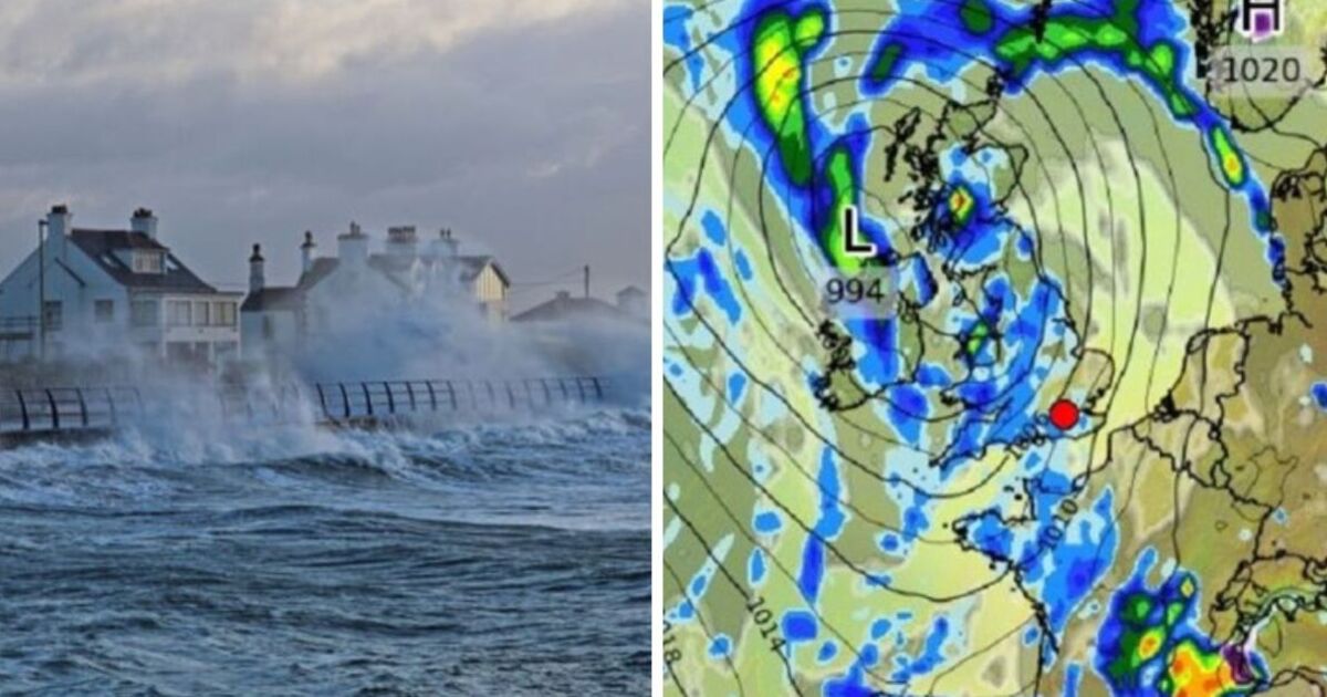
No warnings or names have been issued but a deep low-pressure system sweeping across the Atlantic could mean a barrage of fierce weather including in Cornwall and the West Country. Scotland and the north, however, look likely to miss the worst of the torrent.
Jim Dale, senior meteorologist for British Weather Services, said: “This system is looks unnaturally deep for the time of year and could be fairly venomous when it comes in off the Atlantic on Saturday and through Sunday.
“It is looking like a pretty ropey weekend, with heavy showers and gales which, at the moment, look like hitting southern regions while the north escapes the worst of it.”
According to GB News, he added: “This looks deep enough to warrant another storm name, though it may end up being named by the French meteorological service due to its southerly path, so this is something that we are keeping our eyes on.”
The Met Office agrees that the conditions look “more unsettled towards the weekend”.
In its outlook for Thursday, April 25 until Saturday, April 27 it said: “Gradually becoming more unsettled towards the weekend with showers or longer spells of rain at times.
“Often cloudy and feeling chilly in brisk winds.”
It added: “Temperatures recovering a little on Saturday.”
Its longer range forecast which covers from Sunday, April 28 until Tuesday, May 7 said: “An uncertain start to the period though likely unsettled as a frontal system continues to push north across the UK, coupled with strong winds and possible coastal gales, this likely followed by a showery day with potential thunderstorms on Sunday and again on Monday.
“Beyond this, low pressure patterns continue to dominate with wet weather perhaps more likely to develop in parts of the south and east, though all parts are may see some rain at times. Winds further into the period mostly light to moderate.”
It added: “Temperatures will likely trend near or slightly above average, though some cooler interludes remain possible. Into early May, something of a north-south split looks possible, with relatively drier conditions further to the north and the greatest chance of rain further to the south.”