The national weather service anticipates that multiple areas will meet official heatwave criteria from Saturday through to Monday, with temperatures climbing to 33C in certain parts of the UK on Monday. Saturday may see highs of 30C while 32C is forecast for Sunday, according to the Met Office.
Consequently, Britons will be seeking ways to keep themselves and their properties cool throughout the extended weekend. The Met Office has helpfully released a series of recommendations. For those remaining indoors rather than venturing out to enjoy the sunshine, the Met Office suggests drawing curtains in sun-facing rooms to prevent heat from entering.
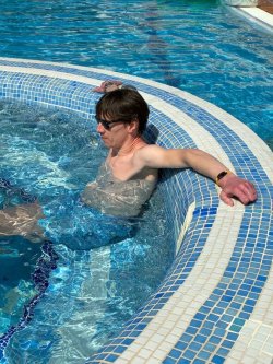
Keep out of the sun and avoid any exercise between 11am to 3pm when the sun is the strongest
Close your curtains in rooms that face the sun
If you are going out, take water with you, keep in the shade, wear sunscreen and wear a wide-brimmed hat
Met Office Deputy Chief Forecaster Steve Kocher said: "Temperatures will climb through the weekend, especially in the south, where 30C is likely to be recorded on Saturday and 32C on Sunday. Temperatures are forecast to peak on Monday when we could see 33C recorded in southern England and the Midlands."
This means the May and Spring UK temperature records will "likely" be broken over the Bank Holiday weekend, he added. The existing record stands at 32.8C. The scorching spell will almost certainly qualify as an official heatwave, which is declared when temperatures exceed the heatwave threshold for three consecutive days anywhere across the country. The threshold ranges between 25C and 28C depending on the county — meaning this weekend looks set to blow well past it.
The Met Office has indicated that heatwave conditions are likely to take hold across parts of the south-east on Sunday, before potentially spreading "across central and western England and into parts of Wales".
However, not every corner of the country will bask in sweltering temperatures. Mr Kocher adds: "There will however be more cloud and some showers in Northern Ireland and western Scotland through the weekend. With relatively low sea surface temperatures there is also likely to be some low cloud and sea fog clinging closely to western coasts."