
Weather models indicate that morning temperatures could soon plummet to as low as 2C in certain parts of the UK – despite the nation still recovering from a record-breaking May heatwave.
The Met Office reports that highs of 29C are possible today and tomorrow across southern areas, with 24C expected in northern regions over both days. Peak temperatures are then forecast to fall to around 20-22C across much of the UK on Sunday and Monday.
However, the GFS weather model suggests a far more dramatic drop may not be far off. On June 11, morning temperatures could plunge to 3C in Scotland and Wales, 4C in Northern Ireland, 5C in the north of England, and just 6C to 7C in the Midlands.
Meanwhile, on June 12, lows of 2C are possible in northern Scotland, with 4C in the north of England, 5C in Wales, and 6C to 7C in the Midlands and Northern Ireland.
The maps suggest that only a handful of counties, predominantly in the south and east, are likely to see temperatures in double digits at 6am across both days.
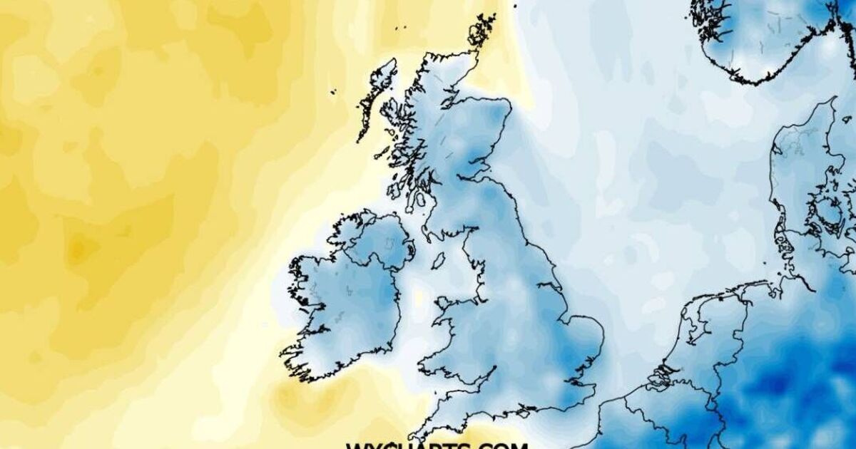
Temperature anomaly maps across both days show swathes of blue across all parts of the UK. This indicates where temperatures are expected to drop below the seasonal average for this time of year.
Met Office's latest weather forecast The Met Office's latest forecast indicates that tonight will remain dry across most of the country, with patches of fog likely to develop in the early hours across the southwest. Rain is anticipated to arrive in the far north-west at dawn.
For Saturday, the national weather agency predicts that rain will sweep eastwards across Scotland and Northern Ireland before pushing into England and Wales by the evening. Sunny intervals are forecast across England ahead of the approaching rainfall.
The Met Office adds: "Fresher for all on Sunday with a mixture of sunny spells and showers. Unsettled on Monday and Tuesday with heavy showers, longer spells of rain and possible brisk winds too."