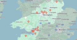
A 728-mile rain bomb is firecast to leave several parts of the UK drenched as unsettled conditions replace glorious sunshine in a matter of hours. WXCharts weather maps show areas from Wick in Scotland to Dorset in south of England will be battered by heavy rain on Tuesday (August 4).
According to the weather maps, the downpours will begin to hit the country at around 9am tomorrow, initially covering most Scottish counties. As the day progresses, rain will quickly spread southwards over other parts of the country, covering large parts of England and Wales, the maps have suggested. The maps come as most parts of England have been placed under drought conditions.
The Met Office’s forecast for Tuesday to Thursday reads: "Unsettled at first, with spells of rain and some heavy showers, especially in northern areas. Conditions gradually improve later, becoming drier for many. Hot in the southeast, cooler further north."
This comes as the forecaster described July as being characterised by an "exceptional combination of extreme heat, abundant sunshine and an almost complete absence of rainfall.
Provisional statistics showed that only 5.6mm of rainfall had been recorded in England in July – less than half of the previous record of 13.4mm set in 1911.
Half of England and the whole of Wales is officially in drought, as successive heatwaves put pressure on water resources.