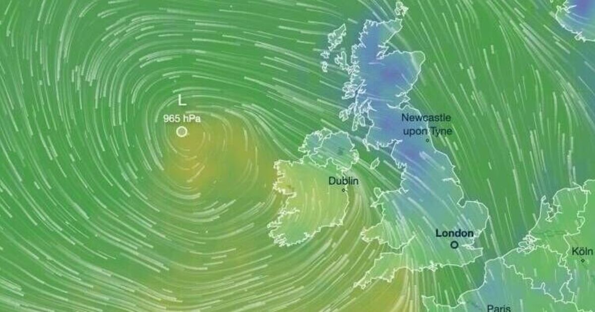

Dramatic weather maps reveal daytime temperatures are set to plummet to a bone-chilling -7C across Britain.
The mercury is expected to nosedive dramatically in the coming days as easterly winds gather strength. The Met Office warns an unsettled spell approaches with hail and thunder forecast, and conditions predicted to "feel quite chilly" in the days ahead.
It marks a sharp departure from Monday's weather, which despite being soggy - with nearly three inches of rainfall battering north Wales - remained mild for this time of year. The thermometer reached 14C in Bude, Cornwall, and 13.6C in Pershore, Worcestershire.
Fresh weather charts, released by forecasters at Metdesk, display a blue wash across the country on Friday. By 3pm on Friday, it will feel as bitter as -7C in certain regions, and as cold as freezing as far south as Essex.
The most frigid locations - the deeper blue shades on the map below - encompass vast areas of Scotland.
The genuine air temperature is likely to be milder but Britons won't sense this - due to fierce gusts from the east. These could reach as powerful as 70mph in certain coastal regions, including south Wales and Devon.
As temperatures persist in dropping into next week, snow is probable, weather experts predict. Blizzards are anticipated to be most severe across northern England, including Lancashire later in the week.
The UK is set for a gradual drop in temperatures, with the Met Office predicting: "Scattered heavy blustery showers will continue in the south and west, these becoming more widespread, with hail and thunder."
As we move into the week, it adds: "Generally temperatures will be close to average, but it will likely feel quite chilly in the often wet and breezy conditions."
Netweather, a blog by rival forecasters, agrees with this unsettled outlook, stating: "Periods of strong winds are also possible, perhaps strong enough for one or two storms to be named affecting the UK.
Temperatures generally around or a little above average, any snow confined to northern hills during colder polar maritime incursions behind lows clearing."
This cold snap follows a series of downpours, which led the Met Office to issue weather warnings on Monday.
Wales bore the brunt of the bad weather, particularly in the north, but the North West and South West of England also experienced heavy rainfall.
In Shap, Cumbria, the Met Office recorded over two inches (62mm) of rain, while Okehampton, Devon saw around 1.5 inches (38.8mm). Consequently, flood warnings have been issued, including several alerts across East Yorkshire and North Yorkshire.