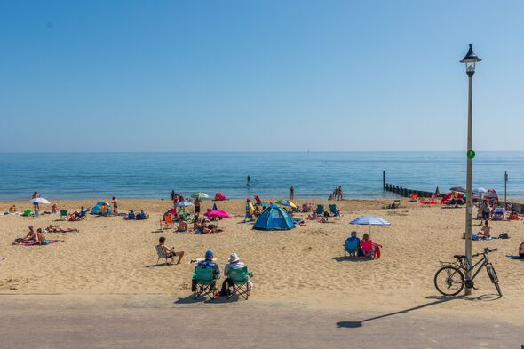

Newly released weather data shows that hot temperatures are set to sweep over 24 counties this weekend. Data from forecaster WXCharts.com shows large parts of the country turning yellow as temperatures climb into the mid-teens and early twenties on Saturday.
According to the weather maps, southern England is set to be the main beneficiary of the warm weather, with areas such as the south west of London with 21C, and Kent and Suffolk with highs of 20C. Elsewhere, central London could prove to be the warmest area of the country, with the forecaster predicting that the mercury will hit 21C. A Met Office forecast for Friday to Sunday said: “Changeable into the weekend, with a mix of sunny spells and showers. Showers may become increasingly heavy, with the risk of thunder. Chilly in the north, warm in the south.”

Despite the prediction of a mild weekend by the UK forecaster, WXCharts.com remains more optimistic, with temperatures in excess of 17C stretching almost uninterrupted from the Midlands to the South Coast as well as South West and South East England.
Other parts of the country are unlikely to be as blessed by the summer conditions, with only the east of Wales expected to see temperatures in the high-teens, while the majority of the country is expected to experience modest temperatures.
Northern England and Scotland will also see mild temperatures, with highs of 5C degrees expected in the Scottish Highlands.
The warm weather comes after the UK saw its seventh warmest April on record and its fourth sunniest.


April saw an unsettled start, with a mixture of spring showers, colder spells and brief warmer interludes. The first week of the month also saw Storm Dave, the fourth named storm of the season, bringing very strong winds, snow and heavy rain to parts of Northern Ireland and Scotland.
As the month progressed, high pressure became increasingly dominant, leading to longer spells of settled weather, clearer skies and warmer temperatures for many.
Several counties experienced one of their driest Aprils on record, including Cambridgeshire (second driest), Norfolk (third driest), Bedfordshire (fourth driest), Essex (fifth driest) and Kent, Hertfordshire, Northamptonshire and Greater London all seeing their sixth driest.
In contrast, parts of north‑west Scotland, including the Western Isles and Inverness‑shire, experienced above‑average rainfall, particularly during the first half of the month.
Separately, Met Office scientist Dr Emily Carlisle said: “The overall dry signal this April masks some pronounced regional differences. Persistent high pressure frequently kept rain‑bearing systems away from southern and eastern parts of England, leading to notably low rainfall totals in areas such as East Anglia.
“At the same time, parts of north-west Scotland remained more exposed to Atlantic systems, particularly during the first half of the month, resulting in above‑average rainfall there.
“These patterns are a good example of how the same month can look very different depending on where you are in the UK.”
Leicestershire
Shropshire
Cambridgeshire
Northamptonshire
Warwickshire
Herefordshire
Worcestershire
Hertfordshire
Huntingdonshire
Gloucestershire
Buckinghamshire
Oxfordshire
Bedfordshire