The Met Office has issued one of its most frightening heatwave updates yet - warning about a developing weather phenomenon becoming more frequent during ongoing summer wildfires on the continent.
Today, Wednesday, June 29, the forecaster issued an update about the ‘unusual’ weather systems impacting both the UK and Europe.
The weather experts have cautioned that the extreme wildfires seen across Spain and France could even get worse in the coming days.
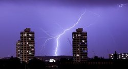
Even more worryingly, the Met Office set out how these wildfires can directly change the weather by creating their own thunderstorms.
It said, in a quasi-biblical description of the chaos unfolding, that thunderstorm clouds ‘generated by the intense heat’ can then extend into the stratosphere, create ‘dry lightning’ and then directly spread the wildfire to other areas as a “fire breathing dragon of clouds”.
The Met Office explains: “One of the more unusual features associated with large wildfires is the development of pyrocumulonimbus clouds – towering thunderstorm clouds generated by the intense heat from fires rather than traditional atmospheric processes.
“As fire-heated air rises rapidly, smoke particles provide ideal surfaces for water vapour to condense onto. This allows cloud development, with some storms growing to heights of 10–15 kilometres and extending into the stratosphere.
“These clouds can create additional hazards. Strong downdrafts may help spread fires, while dry lightning can ignite new blazes several kilometres away from the original wildfire. NASA has described these clouds as the “fire-breathing dragon of clouds” because of their ability to worsen wildfire situations.
“Recent examples have been observed in France, where they have contributed to worsening wildfire conditions.”
In the UK, dry weather is still the biggest concern, with several parts of England and Wales recording ever longer spells without precipitation.
Our community members are treated to special offers, promotions, and adverts from us and our partners. You can check out at any time. Read our Privacy Policy
It added: “Back in the UK, dry weather remains a key theme, particularly across England and Wales. Many observing stations have recorded long runs without measurable rainfall, and several locations are continuing to add to those totals.
“However, rainfall prospects differ sharply depending on location.
“Northern Ireland, Scotland and parts of northern England are expected to see repeated bands of rain through the remainder of the week. Some areas of Scotland could receive 30–40 mm of rainfall, with locally higher totals possible.”
But for warmer areas, the spell of heat and dry conditions is set to last right into next week.
It added: “For many, the heat may ease somewhat after Wednesday, but significant rainfall remains in short supply across southern Britain, meaning dry conditions and elevated wildfire concerns are likely to remain a feature of the weather in the days ahead.”