


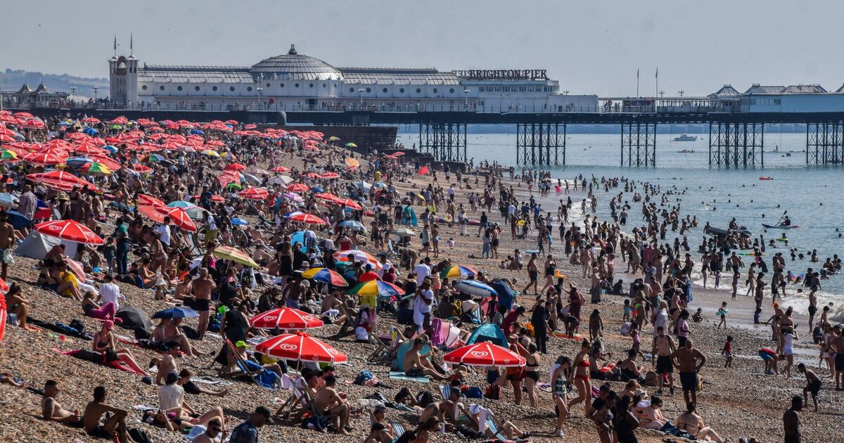
Britain is likely to witness warmer weather through the week with areas such as Heathrow sizzling at 29C on Tuesday. The high temperatures are likely to stay for most of the week, but it cannot be termed a ‘heatwave’ by the Met Office.
Weather maps show the temperature levels are likely to oscillate between 27-29C from Tuesday to Thursday for most parts of the UK, bringing in the much warmer weather.
In the coming days, the UK is set to experience the highest temperatures of the summer so far as warm air moves northwards.
Scotland and Northern Ireland are expected to see their warmest weather on Monday, with temperatures reaching 24 to 26C, before cooler and cloudier conditions arrive from the west on Tuesday.
However, in England and Wales, the heat is likely to persist longer, with midweek temperatures expected to reach 28 or 29C in the South East, accompanied by abundant strong sunshine.
Some areas might meet the Met Office’s official heatwave criteria. Nights will also be warmer and more humid than we have experienced recently.
The Met Office defines a ‘Heatwave’ as “A UK heatwave threshold is met when a location records a period of at least three consecutive days with daily maximum temperatures meeting or exceeding the heatwave temperature threshold”.
The threshold here is 28C and if it continues for over three consecutive days, then the weather condition can be defined as a ‘Heatwave’.
Dan Rudman is a Met Office Deputy Chief Meteorologist. He said: “After a brief, less settled interlude today and tomorrow, fine conditions will return by Sunday and into the beginning of next week. For much of the UK this will be accompanied by a boost in temperatures with many places reaching the mid-20Cs.
“Some central and southern areas are likely to see temperatures approaching the values needed for heatwave conditions.
“Heatwave conditions need to remain in situ for three consecutive days, and by the beginning to middle of next week it is possible that some parts of the UK could be reaching heatwave thresholds.
“However, whether or not everyone experiences heatwave thresholds, the majority of the UK will experience the highest temperatures so far this year.”
Jim Dale, a meterologist with British Weather Services, told Express.co.uk: “At the moment, we are in the exchange of transition between relatively cold weather of June into a warmer, hotter stroke.
“What we will see is sun reactivity, a mix of situations, either the temperature will go back to average or beyond average.
“The weather is mixed for sure with some showers, thunderstorms, and above-average heat.”
Today:
A band of cloud will linger across parts of Wales, the Midlands and parts of southern England today, but there will be some brighter spells at times. A fine day elsewhere with sunny spells and feeling rather warm.
Tonight:
Largely cloudy across parts of the south tonight, with drizzle over hills in the southwest. A few fog patches possible near the south coast. Clear spells elsewhere and rather mild.
Monday:
Largely dry with sunny spells and feeling very warm or hot. However, staying cloudy around some coastal areas. Cloudier in northwest Scotland with outbreaks of rain.
Outlook for Tuesday to Thursday:
Hot with sunny spells over the next few days. There will be a gradual change to less hot weather as rain starts to move in from the west from mid-week.