


The maps show a large body of warm air moving up from the Iberian peninsula around July 23 – July 24.
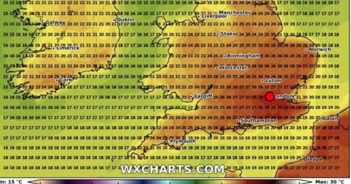
London and the south of England are set to experience the warmest weather with temperatures expected to surge to between 27C-30C.
Temperatures in Wales are expected to soar to between 23C-26 C while Scotland will be cooler, temperatures could still reach a modest 22C.
While the north of England is set for 24C to 25C highs, Norfolk, Oxfordshire and the Midlands could see heat hit the mid-20s.
In a weather outlook for July 23-August 6 the Met Office expects temperatures to be “above average”.
A spokesperson for the Met Office said: “There are some signs of a slightly greater than normal chance of a more prolonged settled spell developing at some point during the period, at least for a time, and perhaps more likely in the south.
“However, by the same token further, perhaps shorter, unsettled interludes are probable too. Above average temperatures overall, and drier than average conditions overall, are very slightly favoured.”
As well as a temperature spike on July 23 and 24, it also looks likely another higher band of temperatures could be enjoyed around July 17 giving some brief respite from a decidedly un-summery start to the school holidays.