


After a very brief heatwave earlier this week, UK weather maps suggest Britons will soon go back to much lower temperatures and fluctuating conditions for the rest of July.
The graphics note thermometers across most of the country will struggle to reach past 24C over the next few weeks.
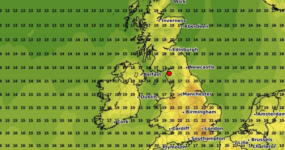
From Monday, July 22, southeastern England is set to experience a considerable cooldown, with temperatures dropping to the mid-teens in the morning to rise into the low 20s in the afternoon.
Northern Ireland, Wales, and Cornwall can expect highs of 19C on Monday, while most of Scotland will drop between 11C and 16C.
Conditions are not expected to improve as we head into August as weather maps forecast thermometers will stick to up to 24C – a considerable drop compared to the 32C highs Britons have been basking in in some areas.
The Met Office’s long-range forecast warns conditions will turn rainier from July 25 before the weather settles towards the end of the month.
The forecast reads: “Through Thursday and Friday a band of cloud and rain pushes southeastwards, with some heavy bursts, and a chance of a few showers forming ahead of the rain.
“Likely becoming more settled into the following weekend with the potential for warmer or thundery conditions for a time in the south.
“Thereafter changeable weather patterns seem likely to resume early in August. Showers and occasional spells of rain are likely to affect all regions at times.”
The forecast added: “However, some drier and brighter interludes are also expected, these most likely in southern and eastern regions.
“The most frequent spells of wet weather are most likely to be across northern and western areas.
“Temperatures mostly close to average for a time, with any warmer spells generally short-lived.”