


Hurricane Helene strengthened to a catastrophic category 4 storm as it barreled toward Florida’s Gulf coast, making it one of the most powerful storms to hit the US this year.
The storm is expected to make landfall on Thursday night. Forecasters warn the enormous storm could create a “nightmare” scenario, with a potentially life-threatening storm surge that could reach 15 to 20ft (4.6 to 6.1 meters) in the Big Bend area of Florida’s Panhandle region.
Much of Hurricane Helene’s gathering strength comes from the waters of the Gulf of Mexico, which have reached unprecedented high temperatures in recent years. In general, the ocean waters around Florida have also seen rising temperatures, making the state more susceptible to catastrophic storms.
By Thursday afternoon, the storm had already strengthened into a category 3 hurricane in the Gulf waters and was expected to become more powerful before it makes landfall. It was about 200 miles south-west of Tampa at midday and slightly gained speed moving at 16mph.
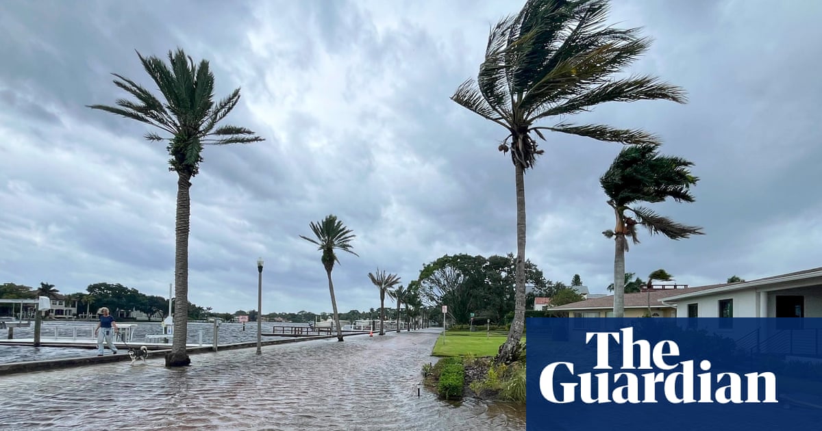
Ahead of its arrival floods from a storm surge were already hitting some cities and communities like Fort Myers Beach, where water was already 2ft above normal.
The winds have already left about 180,000 Florida homes and businesses without power.
Early on Thursday, the storm’s maximum sustained winds were near 110mph (175km/h) with higher gusts. Hurricane-force winds extend as much as 60 miles (95km) outward from the center of the storm
Much of the state is under a state of emergency. Though the storm is expected to weaken once it makes landfall, the storm is moving fast and could spread up to 400 miles.
“A catastrophic and deadly storm surge is likely along portions of the Florida Big Bend coast, where inundation could reach as high as 20ft above ground level, along with destructive waves,” the National Weather Service warned on Wednesday evening. “Preparations to protect life and property should be completed by early Thursday before tropical storm conditions arrive.”
The hurricane is expected to travel up the south-eastern coast once it makes landfall, moving from Florida up to North Carolina. Georgia, South Carolina and North Carolina have been put under emergency declaration. At least 50 million people are under hurricane and tropical storm warnings. School districts along Florida’s Gulf coast and in Georgia, including in Atlanta, will be closed on Thursday in anticipation of the hurricane’s arrival.
Joe Biden declared a state of emergency on Tuesday, ordering federal assistance to Florida. Mandatory evacuations in the state started to go in place earlier this week.
The Federal Emergency Management Agency (Fema) is expecting the storm to inflict damage across several states.
“This is going to be a multi-state event with potential for significant impacts from Florida all the way to Tennessee,” The Fema administrator, Deanne Criswell, warned during an appearance at the White House press briefing.
Cities as far north as Asheville, North Carolina were seeing heavy rain starting Wednesday night as the furthest edges of the storm move north.
The North Carolina governor, Roy Cooper, told residents in a new conference Thursday that the storm cold bring “heavy rain and potentially catastrophic flooding tonight and tomorrow for central and particularly western North Carolina”.
Florida’s governor, Ron DeSantis, warned residents across the state of the impending damage the storm is expected to deliver.
“It’s not a matter of whether we’re going to get effects, it’s just a question of how significant those effects will be,” DeSantis said on Wednesday.
State officials warned residents on Thursday that time to evacuate is running out.
“You do have time to evacuate, but that time is now,” said Kevin Guthrie, Florida division of emergency management director, said Thursday morning.
Officials in Tallahassee, the state’s capital, said the storm could be the worst in the city’s history.
“If our community remains central in Helene’s path, as forecasted, we will see unprecedented damage like nothing we have ever experienced before as a community,” Tallahassee’s mayor, John Dalley, said at a news conference on Wednesday.
Early Thursday, the National Weather Service said the impacts of the storm would depend on its track, though widespread power outages, damage to infrastructure, including power lines, blocked roads and damage to structures are all possible.
“Power outages will likely last days, if not weeks, near where it makes landfall,” the National Weather Service said on Thursday.
The hurricane will be the fourth to make landfall in the US this year. This is the second major hurricane to hit the state this year. In August, Hurricane Debby, a category 1 storm, brought power outages and flooding to the north-western part of the state.
The impact of the storm will be felt far from the Gulf coast.
The North Carolina governor, Roy Cooper, warned of the intense rains it was likely to bring as it moved inland. “This is an unusually dangerous storm that threatens to bring heavy rain and potentially catastrophic flooding tonight and tomorrow for central and particularly western North Carolina,” Cooper said.
He added major cities in the state such as Charlotte and Asheville could see flash flooding despite not being directly in Helene’s projected track. In Asheville more than 7.5in of rain had already fallen since Wednesday night and it only needed another 2in to be a once-in-1,000-year rain event for the area, according to the Southeast Regional Climate Center.
Meanwhile in Georgia, Atlanta issued a rare top-level flood warning: a level four on a scale of four for a high risk of flooding rainfall.