


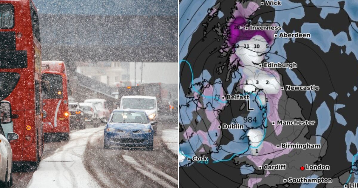
The UK is to be blasted by blizzards on March 4, with inclement conditions found as far north as Wick, Scotland, and as far south as Plymouth, according to latest weather maps.
In total, ten areas of the country will be hit, with as much as nine inches of snow predicted by WX Charts in the Scottish Highlands.
The snow is forecast to hit from late March 3, but will arrive in earnest on March 4 for most.
The flurries and rain will be accompanied by freezing conditions. Much like the snow, the worst of the weather will be found in the Highlands and northern Scotland, with temperatures as low as -4C. Elsewhere, Brits should expect the mercury to hover around 0C.
The areas to be hit are:
- West Country
- South Wales
- Mid Wales
- West Midlands
- North-west England
- North-east England
- Scottish Borders
- Central Belt
- Scottish Highlands
- Northern Ireland
It is important to note that the Met Office, the UK’s official weather forecaster, does not predict snow on specific dates so far in advance.
That’s because the factors that cause snow are variable and can change significantly as the date in question approaches.
Today:
A dry, bright start for most, but cloud increasing with a band of rain moving east but weakening, with the far east likely to remain dry. Rather windy with coastal gales possible in the north.
Tonight:
Largely cloudy, with another band of rain, heavy at times, moving eastwards overnight. Windy for many, with coastal gales in the north and west. Increasingly mild, especially in the southwest.
Thursday:
Outbreaks of rain and blustery showers will move eastwards across the country, interspersed by sunny spells. A mild day although tempered somewhat by the windy conditions.
Outlook for Friday to Sunday:
Staying unsettled with further spells of wind and rain moving across the country. Wettest and windiest conditions will be in the north and west. Remaining mild or perhaps very mild.